Monthly Archives: October 2020

New SnowEx Compact Stainless Steel Hopper

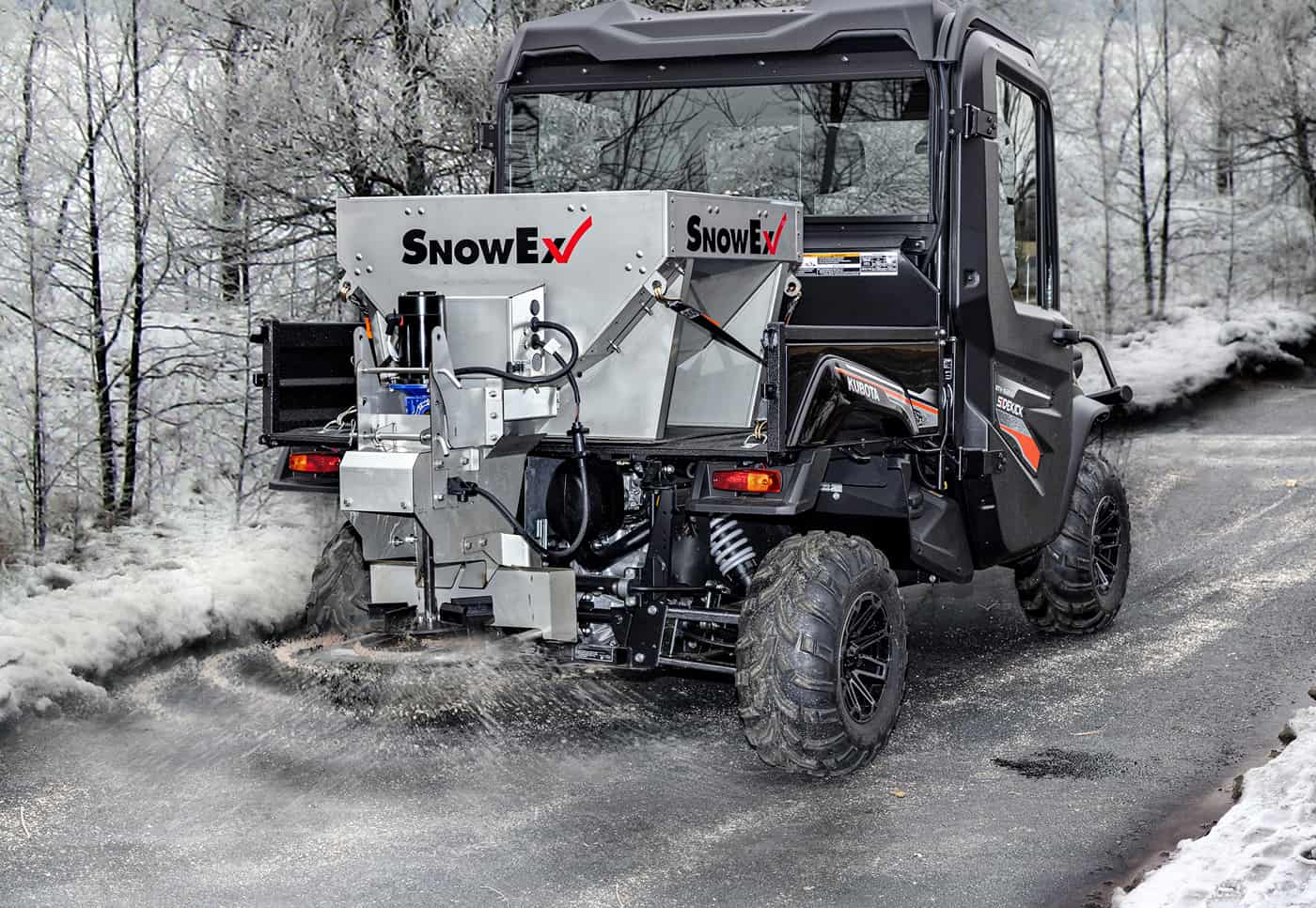
SnowEx Stainless Steel Hopper for Compact Trucks: HELIXX

Now SnowEx Has a Stainless Steel Hopper for Compact Trucks & UTVs


The biggest pain for ice management contractors has always been clogs in salt spreaders. Chipping away at material to keep it flowing is annoying, plus it costs time and money. SnowEx has long been known for its helix corkscrew salt spreading system that greatly reduces clogs on larger trucks. Now SnowEx is introducing the HELIXX 0.35 cubic yard stainless steel spreader specifically developed for UTVs and compact trucks! It offers many of the same features that their larger HELIXX stainless steel hopper has, but in a compact size. Now even when salting smaller areas and sidewalks, drivers can use this innovative HELIXX design that helps prevent clogs and outperforms the material flow of traditional augers.

Perhaps the greatest strength of the HELIXX spreader is the corkscrew designed full length auger. It helps distribute material smoothly and prevents clogs. But there are other noteworthy benefits of this design too. Whether you are using the original larger size HELIXX system or the new .35 cubic yard system for compact trucks and UTVs, they both are designed to extend beyond the hopper and into the patented pre-wet mixing chamber to help prevent leaking/spilling during transport while providing an ideal location for pre-wetting material. The HELIXX spreader also has a cab forward hopper for better payload distribution that reduces stress on your truck and prevents spilling during transport.

Full Length HELIXX Design

Just like its big brother, the compact truck/UTV HELIXX spreader is built for the toughest weather and is corrosion-resistant. It is also unique in that it runs the entire length of the 2.5-foot hopper with the multi-dimensional tub design and vibrator, to promote even unloading of material. The compact design is perfect for maneuvering sidewalks and small areas, but it has a spreading width of up to 30 feet so it is effective for larger areas as well.
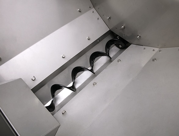
SnowEx HELIXX Full Length Spreader Design

The HELIXX spreader’s hopper and frame are constructed of corrosion-resistant stainless steel. A unique leg and sill design of the frame provides a very rigid structure to maximize service life. To make it easier to clean or access the hitch, the chute can be flipped up or removed.

The are several optional accessories available for the HELIXX 0.35 cubic yard spreader. One is an extension collar that adds height to the hopper walls to increase material capacity. This optional extension collar increases capacity by more than 70% by adding 0.25 cubic yards of space to the hopper. Other available accessories include spill guards, inverted “V” kits for materials susceptible to compacting, vibrator kits, work light kits, strobe light kits, and ratchet strap kits.

About SnowEx

SnowEx Snow and Ice Control Equipment is a part of Douglas Dynamics, a 70+ year old North American manufacturer of vehicle attachments and equipment. Learn more about SnowEx here or see more SnowEx news here.

10/28/20 Forecast: More Early Snow is Coming!

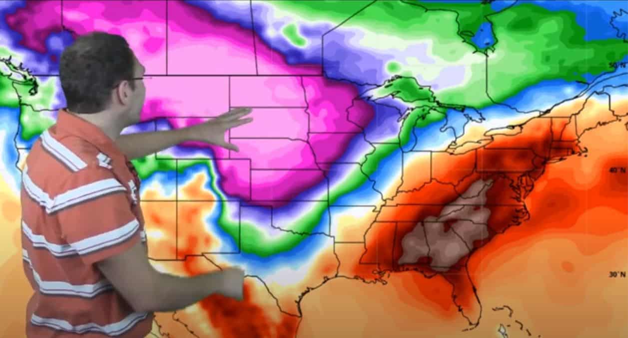
10/28/20 Temperature Weather Map from Neoweather

Weather forecast shows lots of variation this week

The temperature map is a rainbow of colors this week with both higher and lower than average temperatures. Texas is the most interesting with temps ranging from the 20s to the 90s all in one day! Aside from big temperature swings, Neoweather expects to see Hurricane Zeta cause flooding and more early snow will round out the week.

This week kicked off with major cold coming down from Southwest Canada into the Northern Plains and the Rockies. Temps in these areas were 30-40 degrees below average. Freezing rain accompanied these temps and did widespread damage to trees and power lines in Oklahoma and Texas. Today we’re expecting some snow in those areas as well. Hello Winter 2020, you have our attention!

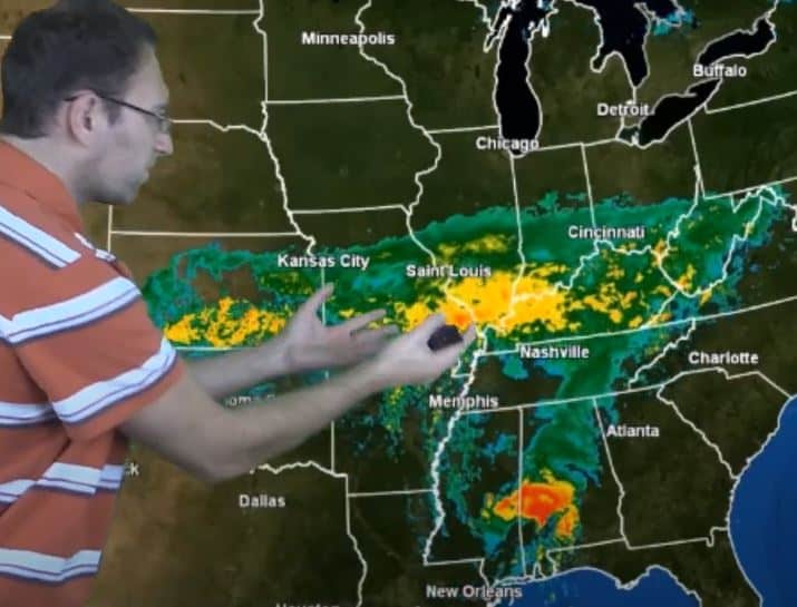
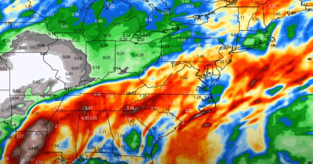
Map of Hurricane Zeta precipitation

Hurricane Zeta & Flooding

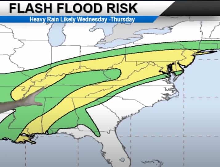
As hurricane Zeta hits landfall in the heavily bruised New Orleans area, it will again bring heavy rains to the already-saturated region. From Wednesday to Friday, the system will move northeast through the Ohio Valley causing a good risk for flooding. By the time it hits New England on Friday it will collide with cold air and have a decent risk of snow forming. 

Map of Hurricane Zeta flash flood risk

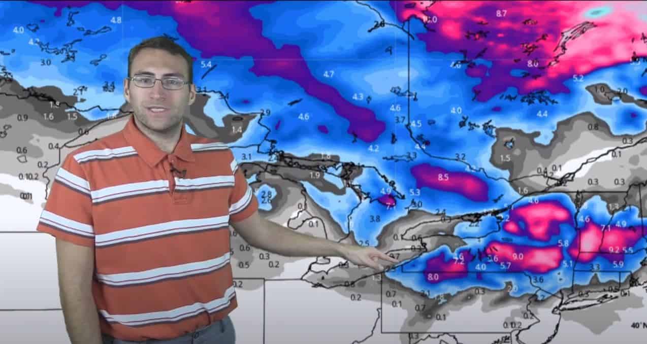
By this weekend, remnants of Hurricane Zeta will be off the coast and no longer dumping rain on the U.S. Friday and Saturday is pretty quiet across most of the country aside from rain in Florida. Then Sunday the next system develops and comes down from Canada into the Upper Midwest and Great Lakes regions. It’s expected to bring more cold and some decent snow to those areas and into New England before it dissipates. Check out the map below showing one model’s forecast where snowfall is expected to be up to 8-9 inches in isolated areas. Most areas are only expected to get a couple inches depending on temperatures.

Monday, November 2, 2020 Snow Forecast Map

11/2/20 Weather Forecast Map showing snow

The temperature anomalies for October 27 – November 10, 2020 are expected to be above average temps on the Pacific Coast and Southeast. The middle of the country and Northeast are expected to be below average.

10/28/2020 Weather Forecast Video

Watch Neoweather’s winter forecast for snow contractors video below as we wrap up October with an early taste of winter. If you haven’t already explored private forecasting services from Neoweather, it’s a great time to consider this service. The forecasts aren’t general like you see here or on generic weather apps. Instead, they focus on YOUR service area with the details you need to make good decisions on when to send out your crews and what equipment and salt to use. Contact Neoweather today!

Sno-Way RVB Drop Spreader

Sno-Way RVB Drop Spreader

Ingenius Design for UTV Spreader Conversion

Sno-Way Intl. keeps at it every year with introducing a lot of innovations to our industry, and we get to share with you an ingenious design trick they implemented to instantly convert a mounted UTV broadcast spreader into a drop spreader.

This feature is really great for buildings and grounds folks where they have a lot of sidewalks, especially properties that have both broad and standard paved foot-paths. You can use the UTV to broadcast spread on a wide foot-path area with the Sno-Way RVB 10 and RVB 500 (10 and 500 cubic foot capacities), which is great because the small UTV is a lot friendlier to get around pedestrian traffic than a pickup (being careful not to broadcast spread into pedestrians, thank you).

But then when you get to standards sidewalks, the broadcast spreaders become useless. A lot of property managers are forced to buy separate equipment and dedicate some UTVs for broadcast spreading and some for drop spreading. If you always wanted to use one vehicle to do both jobs, Sno-Way created your solution by creating a simple hood to convert their broadcast spreader into a drop spreader.

The accessory to change these spreaders to a drop spread pattern costs you peanuts compared to buying a second spreader, so it is definitely worth checking out. 

Sno-Way Drop Spreader Hood Video

Watch Tom Brewer from Sno-Way explain why they created this innovative and simple solution for clients clearing sidewalks and how it works.

You can learn more about the Sno-Way Drop Spreader hood attachment for UTV spreaders here.

How Can We Help?

Would you like to get more information, ask a question, suggest a topic for Snow Plow News to write about, or get news delivered directly to your inbox? Just fill out this quick form below and we'll get on it!

Ram Trucks for Plowing + NEW Snow Plow Prep Package

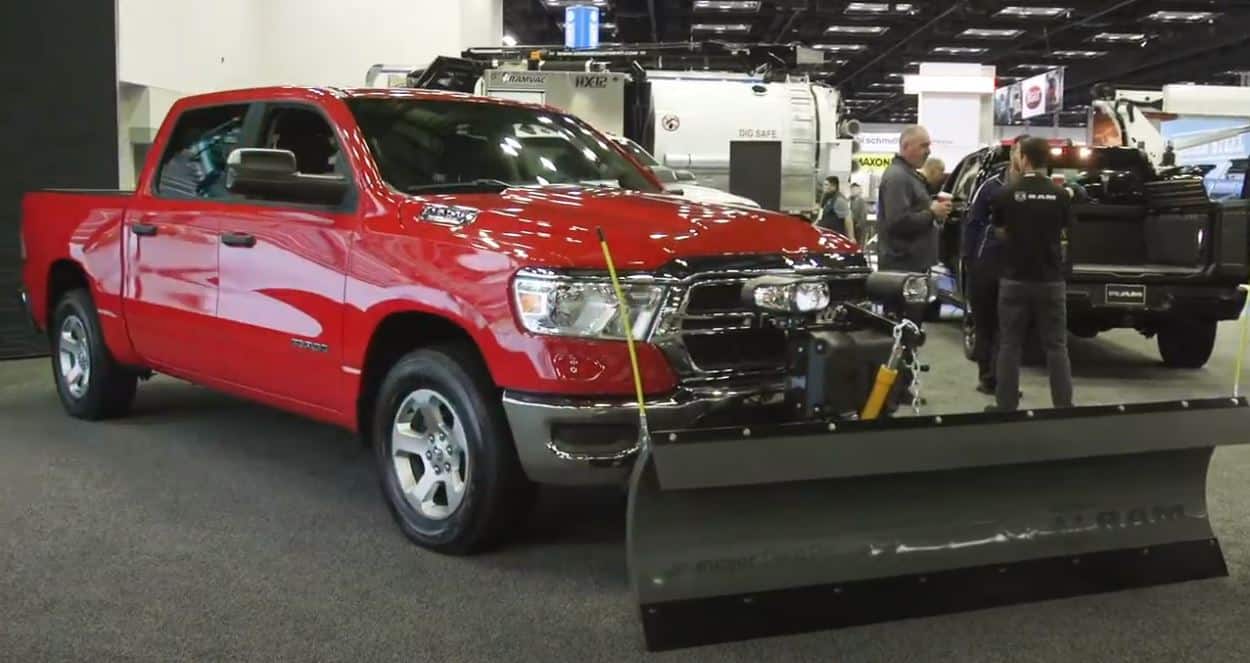
Dodge Ram Snow Plow Truck

Why use a Ram Truck for Snow Plowing?

Snow Plow News talked with Dave Sowers from Ram Commercial at the 2020 Work Truck Show to find out more about using Ram Trucks for snow plowing. He explained how Ram builds in plowing capability from the beginning by building a chassis, frame, and suspension that tough enough to carry a plow and take a beating. They also build the transmissions to endure heavy cycling from drive to reverse, and they build trucks with the electronics configured upfront for plow attachments. In fact, all Ram heavy-duty trucks have many of those features built-in as a standard. In 2020, Ram announced a first-ever snow plow prep package being available for the light-duty Ram truck.

Ram Light Duty Truck Snow Plow Prep Package

At the 2020 National Truck Equipment Association’s (NTEA) Work Truck Show in Indianapolis, Indiana, Ram announced the first-ever Snow Plow Prep Package available for a light-duty truck in their line up. The 2021 Ram 1500 pickup truck will have an upgraded 220-amp alternator, rear power-sliding window with defroster, and truck-side plow wiring harness. With this package, the active air dam is also removed to make way for plow mounts. The list price on this package is under $200 at this time. It will be available on the Ram 1500 Tradesman, Big Horn, and Laramie 4×4 models with the 5.7-liter HEMI V-8, 5.7-liter HEMI eTorque V-8, or 3.0-liter EcoDiesel V-6 engine.

“the key thing now, if you wire properly from a plow perspective, is when you plug in your plow the truck will know it and it turns off things like front collision mitigation, front park sense, active cruise control…”

Dave Sowers

Ram Commercial

Along with the new light-duty truck plow prep package, Ram has set other benchmarks in the industry worth noting (according to prnewswire.com):

  • 35,100-pound towing capacity with Ram 3500
  • 7,680-pound payload with Ram 3500
  • Most capable full-size off-road pickup – Ram Power Wagon
  • Highest loyalty of any half-ton pickup
  • Highest percentage of pickups still on the road over the last 30 years

Plowing with a Dodge Ram Truck Video

Check out what Dave Sowers from RAM Commercial had to say about how Ram trucks are great trucks for snow contractors.

Winter is Here. See When & Where the Snow Is Flying!

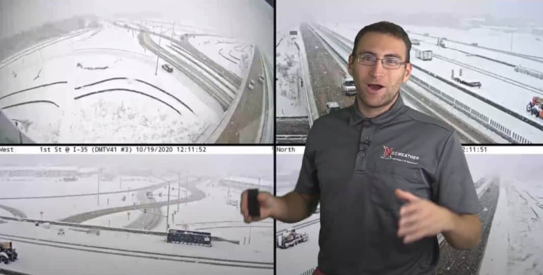
10/20/2020 Snowy Road Cams

Say it isn’t Snow!

A major snowstorm hit Iowa yesterday reintroducing the Midwest to slippery roads and traffic delays. They saw 4-9 inches of snow fall in just a couple of hours, crippling parts of Des Moines and Cedar Rapids. Is there more coming soon? YES! Keep reading for all the details from Brian Ivey at Neoweather.

This week kicked off with that snow covering most of Minnesota, Northern Wisconsin, the U.P., and of course, Iowa. It dipped down from Canada like Neoweather warned us last week, and made a brief visit to the Midwest. Today it’s heading back up to Canada where it belongs and sticking around for a few days up there.

That’s not where the snow action stops this week.

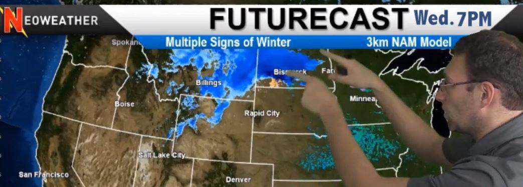
Wednesday another system gets organized in the Northwest, hopping on the active Pacific Jet Stream to bring multiple waves of cold and snow across the area through the Northern Plains.

10/21/2020 Snow in the Northwest and Northern Plains

South of all the snowy action, things are pretty quiet, but we do expect to see some rain in Oklahoma, Missouri, Illinois, and the Ohio Valley, up into New England on Tuesday and Wednesday.

Cold Temperatures Expected

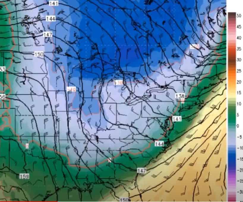
The cold air dipping down from Canada this week and into next week is going to give the Northern Plains and Midwest a spoonful of some pretty cold winter weather well in advance of the norm. This will collide with warmer temperatures pushing up from the South, but the cold will overrule it and most of the country will be cooler than average for a few days. Even Texas and the Tennessee Valley will feel the chill. The cold won’t stick around long in the West, and things will heat up again quickly.

The significance of this drop in temps is that it will amplify the weather pattern and cause a repeat of another cold system and moderate to heavy snow will be likely as it rides the cold air down across the country.

10.22.2020 Temperature Map

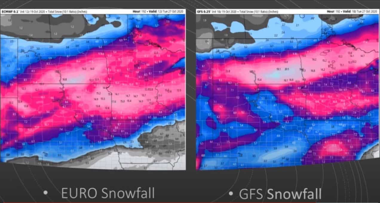
How much snow is expected over the next week? It’s actually pretty scary (or exciting if you’re a snow contractor in the areas below). Both the European model and GFS model are predicting heavy snowfall totals up to 15-20 inches. Brian Ivey cautions the faith in these models but wants to be sure you’re prepared, just in case they are accurate, so he’s sharing them below.

Tuesday, October 27, 2020 Snow Models

10/27/2020 Snow Models

10/20/2020 Weather Forecast Video

Watch Neoweather’s winter forecast for snow contractors video this week with all the details below. If you are ready to explore private forecasting just for YOUR service area instead of relying on generic weather apps and generalized news, Contact Neoweather today!

Hurricane Delta Update & Snow Coming! See Where!

10/8/2020 Weather Maps

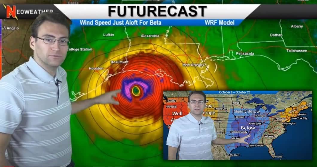
The big news this week is Hurricane Delta blasting Louisiana and the Northern Gulf Coast once again before they even had a chance to recover from Hurricane Laura. Hitting land will weaken Delta, but we’re still expecting 70-90 mph winds as it hits the shore as a Category 3 hurricane. The Pacific Northwest and Great Lakes are the other areas to watch this week as a super cold front dips down from Canada and brings the potential for snow!

This weekend kicks off with Hurricane Delta bringing tons of precipitation after it hits land but the winds will slow down drastically. There will be heavy rainfall, especially through all of Louisiana and most of Arkansas and Mississippi causing widespread flooding. As it journeys north, it will break apart and bring moderate to briefly heavy rains to those areas. Aside from the hardest hits states, most areas in the Southeast will only see 2-3 inches.

10/9/2020 SE USA Rain Totals

Snow on the way for Pacific Northwest

This week the cold air gets serious as it moves through parts of Canada and down into the Pacific Northwest. It is expected to bring some snow to the Rockies over the next week or so and it may start to pile up in Canada. Welcome back, Winter! This is a typical pattern that’s expected to occur throughout Winter 2020-2021. The jet stream is expected to be highly active, causing waves of troughing and ridging bringing the cold Canadian air down. The action starts late next week with a major trough of low pressure dropping temperatures down into the 20s and 30s around the Great Lakes. Time to get out your gloves and winter jackets! We might even see some snowflakes in that area of the country!

Upcoming October Temperatures

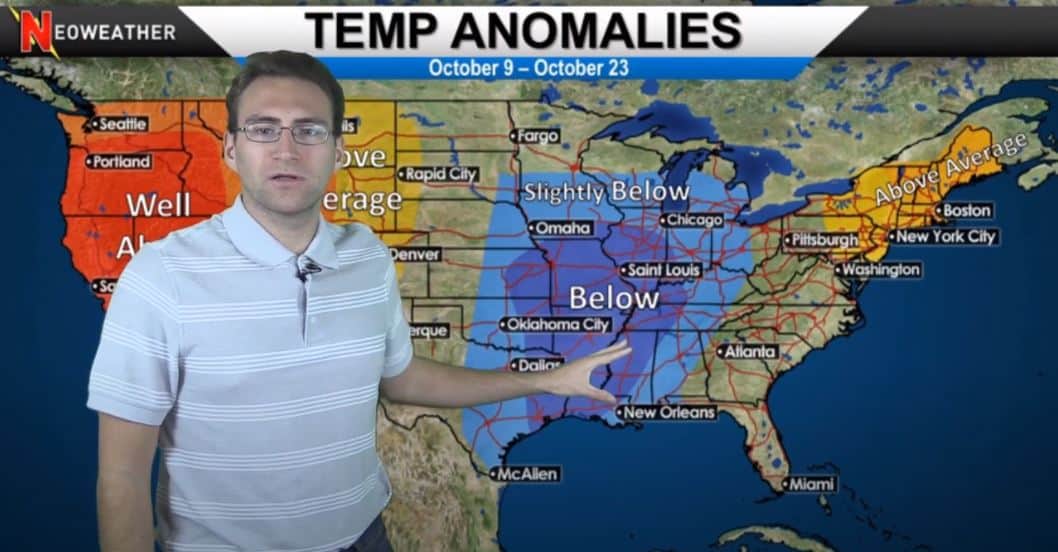
Neoweather takes a look at the expected temperatures across the U.S. for the next few weeks in October. While it’s expected to be way colder than average next week, that pattern doesn’t stick around, and just slightly below temperatures are expected overall for the middle of the country and warmer than average temps are actually expected for New England and the Rockies. Unfortunately, the West will continue to be well above average and dry. California was forecasted to get some significant rain at once point, but sadly that’s probably not going to happen, so hang in there if you’re out that way!

October 9-23 Temperature Map

10/9/2020 Weather Forecast Video

Check out this week’s video with all the details below. And remember, private forecasting services like Neoweather are highly recommended by Snow Plow News to get accurate forecasts for YOUR service area. They are much more accurate than generic apps and news forecasts to help you deploy your crews at the right time and with the best equipment to save you money! Contact Neoweather today for details and pricing.

Is it Late Fall?? Sure Feels Like it this Week!

Neoweather has analyzed the forecast again this week for our snow contractor readers and looks like another active week for parts of the country. However, it’s the East that sees most of the action this week. And even though it’s unseasonably cool in many areas, it’s just multiple rainy systems moving through – no snow expected this week.

10/1/2020 Weather Map showing cool temps dipping down from Canada

The Canadian air is much cooler than normal for this early in the fall already. That air is expected to dip down into the Great Lakes and New England early this week. The rest of the country is covered with a high-pressure system that is keeping it dry with warmer temperatures. That system is expected to move east and help warm up the rest of the country.

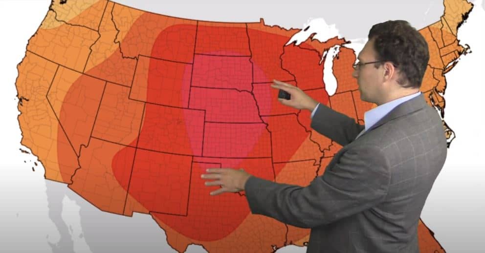
Once the high-pressure system moves east this week, Neoweather if forecasting warmer than average temperatures from coast to coast starting October 8th. The highest temps will be in the heart of the country surrounding Nebraska and neighboring states.

Heat in the Heart of our Country this week

2020-2021 Winter Long Range Forecast Update

Neoweather has a few teasers to their long-range winter forecast this week too. Next week they take a deep dive into this winter’s forecast, but for now Brian Ivey says there is an average jet stream track going through the middle of the country. That may allow for some cold air to push down from Canada often this season – BUT there may be something stopping that from happening! To find out for sure, check out our blog next week when Brian goes into all the details of the long-range winter forecast as well as WHY he’s forecasting those details.

Kick back and watch this week’s forecast video:

Remember, if you’re looking for detailed and specific weather forecasts for YOUR service area, Neoweather can help. Contact them today for details!