This is the second post in a series that looks at the top five 2-day snowfall events for some of our largest and snowiest cities. This week we look at the top 5 snow storms for Detroit. Specifically, we’re looking at the top 5 snow storms for the Detroit Metropolitan Airport located in Wayne County.
Table 1 lists the top five snowfalls at the airport, over two days, since 1958. This table doesn’t match the top five biggest snowstorms for Detroit. Why? Because we stop the term at two days. Some of the larger snow storms to impact Detroit occurred over 3 days or parts of three days and prior to 1958.
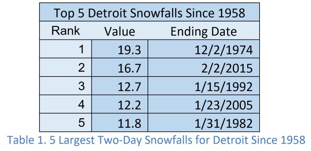
Like Chicago the largest snowstorms in Detroit produce considerable snow but they aren’t very high, compared to other metropolitan areas of the United States. In fact, it is surprising to find that a 12-inch snowfall would rank in the top 5 Detroit snowstorms since 1958. The top five snowstorms produce a range, of 11.8” to 19.3” of snow. You envision Michigan winters and you think snow. Well for Western Michigan and the Upper Peninsula, that is the case. However, Detroit and Southeastern Michigan is not down wind of Lake Michigan and Lake Superior. Detroit is also far enough away from the Atlantic Ocean or Gulf of Mexico that moisture from these sources falls as snow or rain before arriving. These are all significant moisture sources for snow in the Eastern United States. This explains the lighter amounts of snow found in the top 5. The timeframe for our top 5 snow totals is from December 2nd to February 2nd – 3 months. This is a much larger window than Chicago and more typical of cities in the northeast.
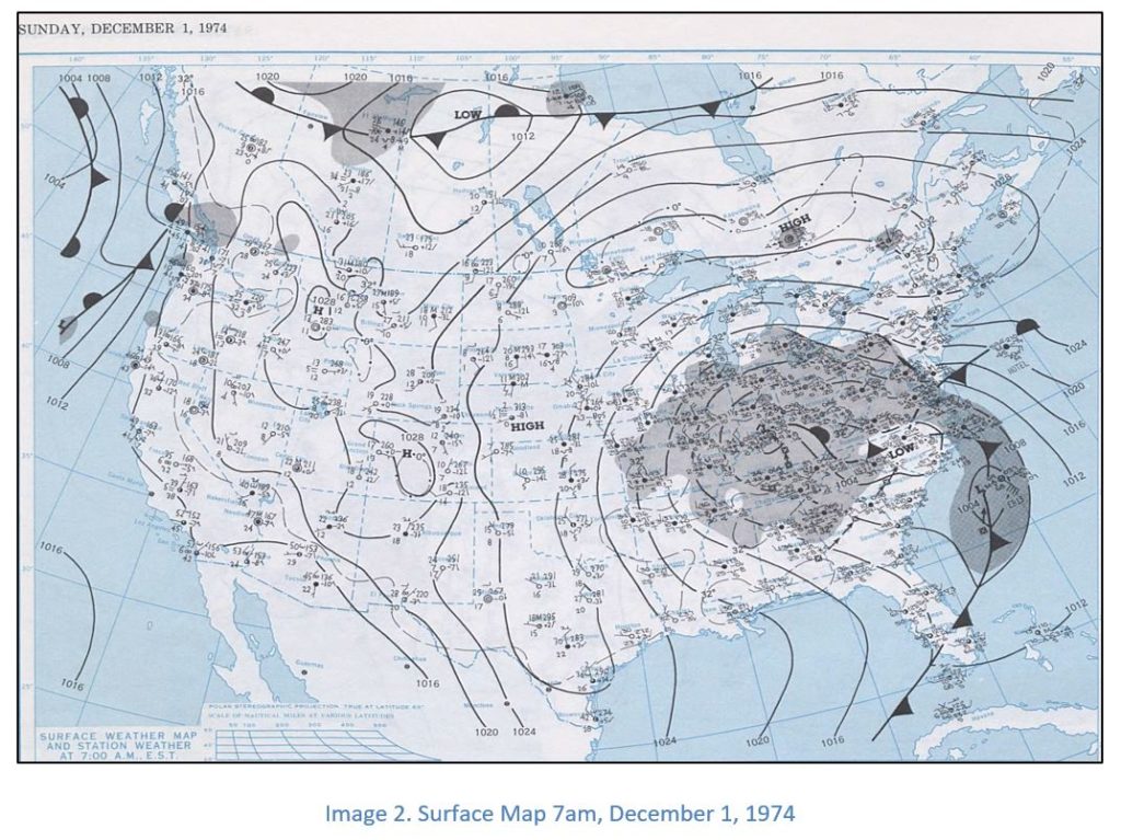
December 2, 1974 Snowstorm
Since Detroit is not downwind or adjacent to any of the Great Lakes, most moisture that feeds snowstorms originates from the Atlantic Ocean and, to a lesser degree, the Gulf of Mexico. The surface map in Image 2 shows an area of low pressure developing in the piedmont of North Carolina on the morning of Wednesday, December 1, 1974. The central pressure is slightly less than 1004mb. This is not a very low pressure. Light to moderate snow is reported at Detroit with a temperature of 30˚F. The surface maps also shows a long fetch from the Atlantic Ocean. Since the storm has occluded, it is likely the lower and mid-levels of the atmosphere Tennessee had a similar fetch. This would transfer a deep layer of moisture well inland towards Detroit and Ohio.
By 7am, Thursday, December 2, 1974 (Image 3), the area of low pressure has moved from the piedmont of North Carolina to southern Pennsylvania and western Maryland. This is very little movement for an area of low pressure over 24 hours. The storm, while moving slowly, also strengthened with the pressure falling to near 992mb. That combination of slow movement and increasing strength resulted in an extended time frame for bringing moisture from the Atlantic Ocean and increased efficiency of snowfall. The temperature at 7am, December 2, 1974 at Detroit was 34℉ with light to moderate snowfall. So, this was a heavy, wet snowfall.
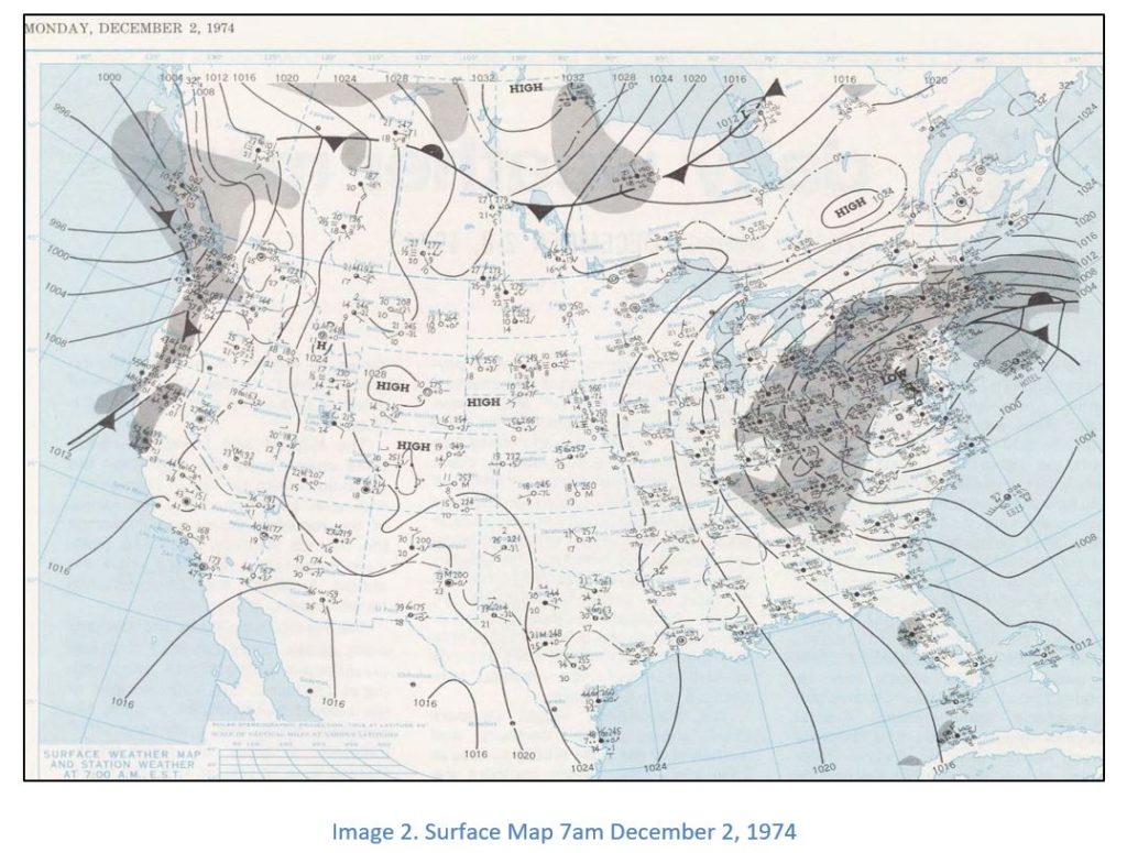
Slow moving storms are common factors in high precipitation events. For the 1974 Super Snowstorm in Detroit, it was a significant factor.
The National Weather Service out of Detroit/ Pontiac has a very good write up on the Super Snowstorm of 1974 here: https://www.weather.gov/dtx/GhostofThanksgivingWeekendSnowstormofthePast