Typically July isn’t a month where we see a lot of rain – but 2020 is anything but a typical year. Not only is the heat dome sticking around, but there is more than average rainfall in most of the country. Check it out!
Today kicked off with big time humidity and precipitation in the Midwest. Lots of rumbling and rain was in the air for folks living in Missouri, Kansas, Iowa, Illinois and Wisconsin. That system is strengthening as is moves east into Indiana, Michigan and onward causing some severe weather for those areas on Thursday and Friday. This will bring a decent amount of rain, but no real break in the heat. Some spots around the Great Lakes will get a couple inches of rain.
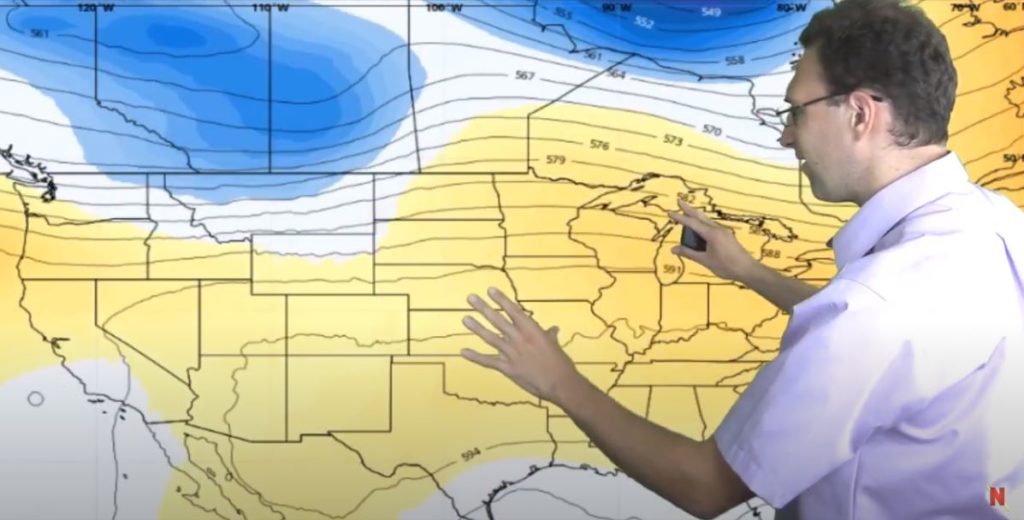
The heat dome really spreads out on Friday with very widespread above average temperatures across most of the country.
This weekend we expect to see more rain in the Midwest. There is lots of green and blue on the map, though nothing looks severe. Precipitation in the Dakotas and Southeastern United States is expected too, but it will be spotty. The West stays dry this week, which is typical for this time of year.
“Ridgerunners” next week will produce above-average rainfall in the eastern half of the country – even more rain in a month that is typically dry. Boooo! And the heat goes on… Check out the WELL above-average temps expected for the Northeast next week. Keep lots of ice-cold water on hand if you’re in New England, because it’s going to be a scorcher!
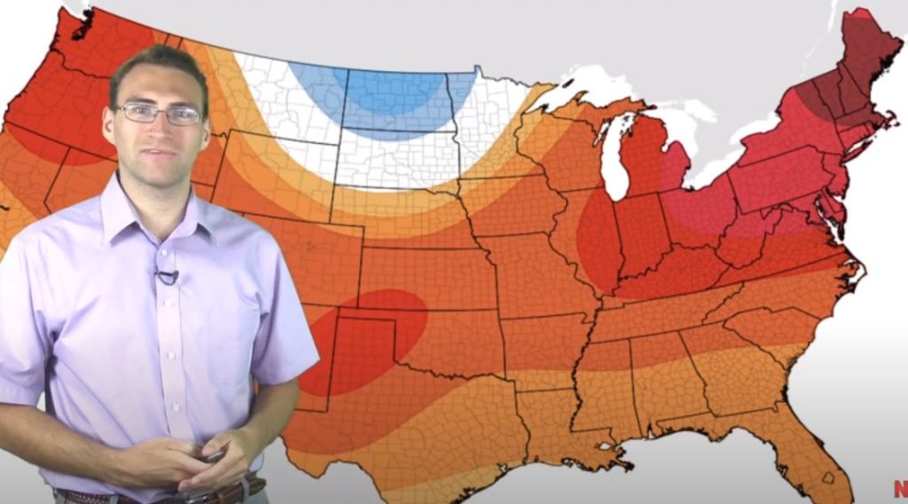
Holy Hotness, New England!
If you want cool weather, you’ll need to head to the Northern Plains for refuge!
Looking for detailed, accurate weather information just for YOUR service area? Look into Neoweather today! The forecasts you see here are generalized for our widespread audience, but Neoweather specializes in custom weather just for YOUR area.