The big news this week, of course, is Hurricane Laura. It’s expected to bring catastrophic damage to the coasts of Eastern Texas and Western Louisiana. Aside from that, Neoweather expects to see decent amounts of rain on the eastern half of the country and above average temps continue. See all the details below while Brian Ivey presents this week’s forecast in a bright new tropical shirt! 🙂
Looks like Mother Nature is done messing around with hurricane teasers and is whipping up a major storm with Cat 3 or Cat 4 potential by the time it hits the coast later today and tomorrow. Hurricane Laura is well defined and threatening to bring 120-150 mile an hour wind gusts and tornadoes to Eastern Texas and Louisiana. Houston will get heavy winds and rain, but the worst of it is expected to be east of that area. After landfall, Hurricane Laura is expected to move north into Oklahoma before it weakens to normal precipitation and swings east.
Starting Friday the eastern half of the country is looking pretty green with widespread showers being forecasted nearly everywhere. Reminents of Laura cause some of the rain, but there is also a system coming down from Canada creates moisture and precipitation.
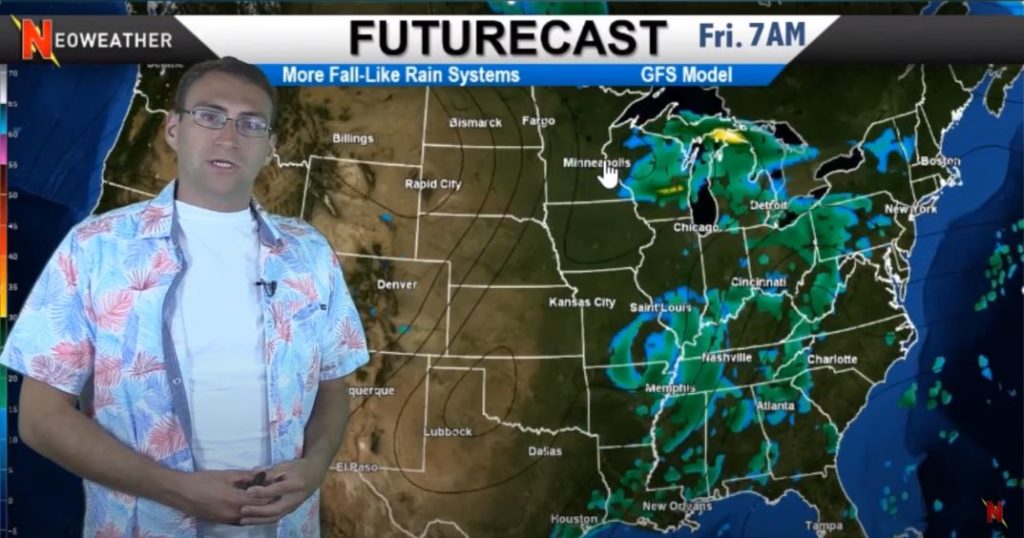
Once those systems move out, Neoweather expects to see cooler temperatures in the Upper Midwest late in the weekend. That front will product some active showers and high potential for thunderstorms in Missouri by early next week.
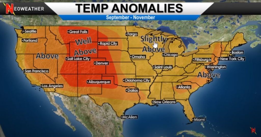
This week there will be more of an active weather pattern, more typical of what we would expect to see in the late summer, early fall. Speaking of fall, what kind of weather is expected based on the long term forecast models? Warm! The September through November temperature anomalies show varying degrees of above average temperatures throughout the country. As you might have guessed, the Western Rockies is expected to be well above average temps as the heat dome hangs on. The rest of the country is either above average or just slightly above average temps.
Weather apps and general forecasts are not meant to be used by weather-based companies to make their business decisions. That’s where Neoweather comes in. They can present you with all the details you need to deploy your crews at the right time, with the right equipment based on YOUR specific service area. Contact Neoweather today for details on how they can save you money.