It’s all over the news, so it’s no surprise to you that Hurricane Sally is pounding Louisiana and the South. But what is expected as it moves through and in the rest of the country? Brian Ivey from Neoweather takes a look at that and this week’s weather forecast below.
Today Sally is expected to make landfall with winds up to 120 miles an hour as it S L O W L Y moves over the already saturated land around the Florida Pan Handle and Eastern Louisiana. After it hits the northern Gulf Coast, Sally will weaken a little, but it continues to show a lot of red on the map as it moves northeast across Alabama, through Georgia and onward. We expect to see areas impacted by Sally to see 10-15 inches of rain!
What is the rest of the country going to see for weather? Brian says the next 10 days will be very dry everywhere that Sally doesn’t touch. There might be a little rain up in the Midwest but that’s just a slight risk due to a high pressure system that is expected to break up anything that comes its way. Everywhere except the Southeast is expected to be dry.
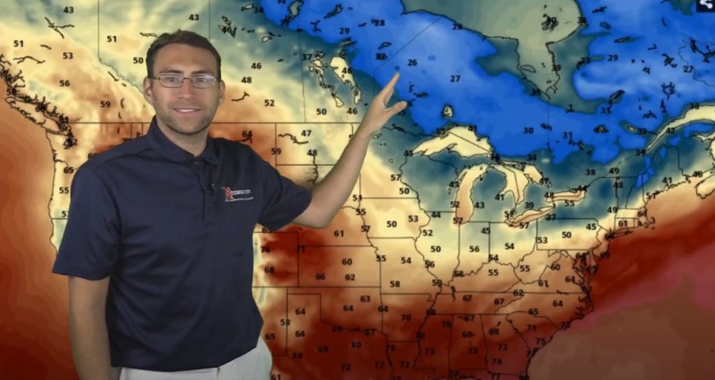
What about the temps? While it will probably be dry, the temps are expected to be cooler than average in the northern half of the country in the coming days and weeks so don’t gloat too much just yet! Brian expects to see waves of much colder than average temps coming down from Canada throughout September. Some areas will get nighttime lows in the 30s and 40s at times with daytime highs in the 50s!
If you are looking for help with more accurate weather forecasts targeting YOUR service area, check out Neoweather! They specialize in making custom forecasts focusing on the details that make a difference for snow plow contractors!