Bitter cold and snow kicked off early in October and November for the Midwest and Great Lakes area, but it’s far from over. Watch the video below to get a long range winter forecast for the Midwest where Neoweather combines the most reliable models to try and prepare you for what’s coming your way this winter. Check out other Snow Plow News blogs for nationwide and other long range forecasts for different regions.
Neoweather expects very active weather across the Midwest this winter. The typical jet stream cold will come down from Canada, but the lakes are expected to stay warmer causing above average lake effect snowfall. The most frigid air is expected to hit in early January when the most lake effect snow is expected to blast northern and western Michigan as well as Cleveland. If the lakes don’t freeze as expected, the lake effect snow becomes a big issue for these areas. Frequent clippers are expected across the region bringing reinforcing cold air behind them along with a wind shift that will favor more lake effect snow.
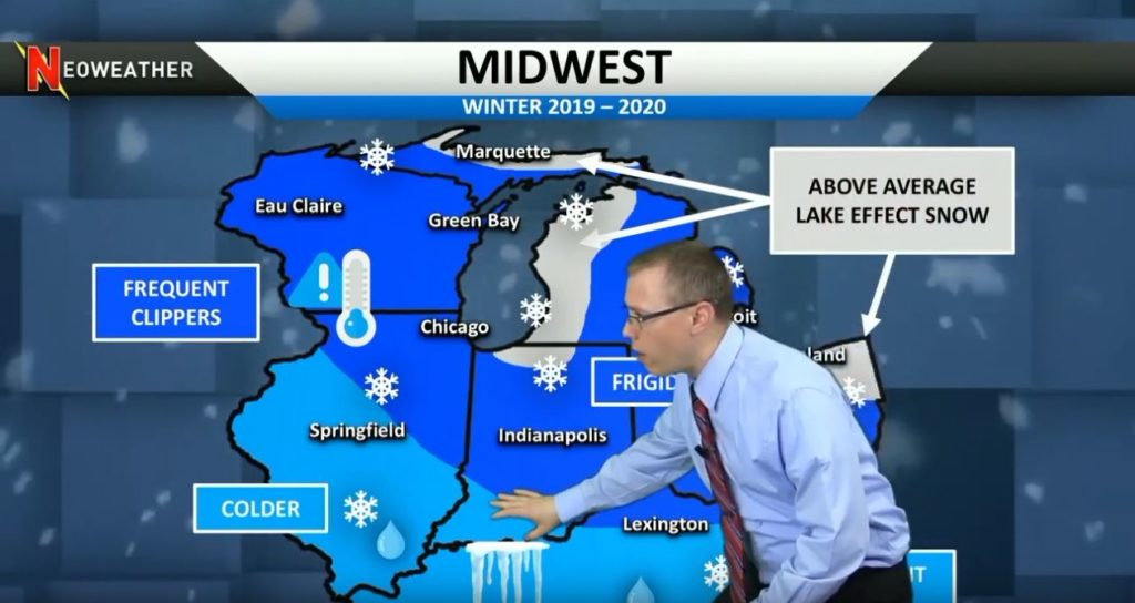
In the lower Ohio Valley and mid Mississippi Valley it will still be cold with some snow, but Neoweather is also predicting rain and ice. From the Nationwide forecast we know that this is where the pressure systems merge. Higher than average temperatures from the Southwest merging into lower than average temperatures in the North will make the Southern Midwest region experience rain and ice.
Looking for more long range forecasts? Check out other weather forecast blog posts from Neoweather brought to you by Snow Plow News!