What does February 2020 have in store for us yet this year? Looks like warmer temps for most of the country for the next couple of weeks, then we may end on a colder note. Is Spring starting early? Will more wintery fun be on the way? See Brian Ivey’s February long range forecast based on following the most accurate weather models.
February 2020 Winter Weather Long Range Forecast Update
Everyone is wondering – will we see Spring early? It’s been above average temps on the coasts and Midwest with only the Rocky Mountains and portions of Texas with average to below averages in temperatures so far this month. As we move through the month, we’re expected to see some shots of cold air in the north with the heart of the arctic blast residing in Canada. But warmer weather from the south moves in to shut off that cold air from moving much into the U.S.
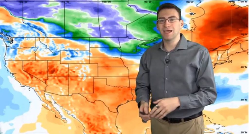
The end of the month will have a few days of spring like weather even in the north as a warmer spell hits Canada as well. That’s expected to be pushed out by a colder pattern coming across from the Rockies that might end the month on a cold note. So will March come in like a lion? Looks like a strong possibility! We could see some snowfall by Feb 29 in much of the country if things build up like expected.
February 2020 Precipitation
While the next couple of weeks are expected to be drier than usual, watch for some moist air to move into most of the country with the exception of the Pacific Coast. Going into Spring, moisture will return to the Tennessee Valley, Ohio Valley, Great Lakes and across the norther portion of the country. That could create a lot of active weather patterns and storms going into Spring. The Southwest is expected to be drier than average.
Love these long range forecasts as much as we do? Check out more from Neoweather or subscribe to their services today!