While we’ve seen lots of spring-like weather lately, it looks like winter isn’t over quite yet. This week kicks off with lots of additional rain in the Southeast (even up to 6 inches!) and storms. Then later in the week a decent sized snow event bursts out of the Rockies and moves across the country turning to rain eventually as it hits well above average temps.
This week starts off with loads of rain in the Ohio, Tennessee and Dixie Valleys. They don’t need it, but they are getting even more rain in these areas. Most areas are getting 1-4 inches Monday-Wednesday. Batten down the hatches because some spots have seen a month or even two months of precipitation just in the last week! Most of the precipitation is expected in the middle of the country this week. It dries out a bit as it moves east.
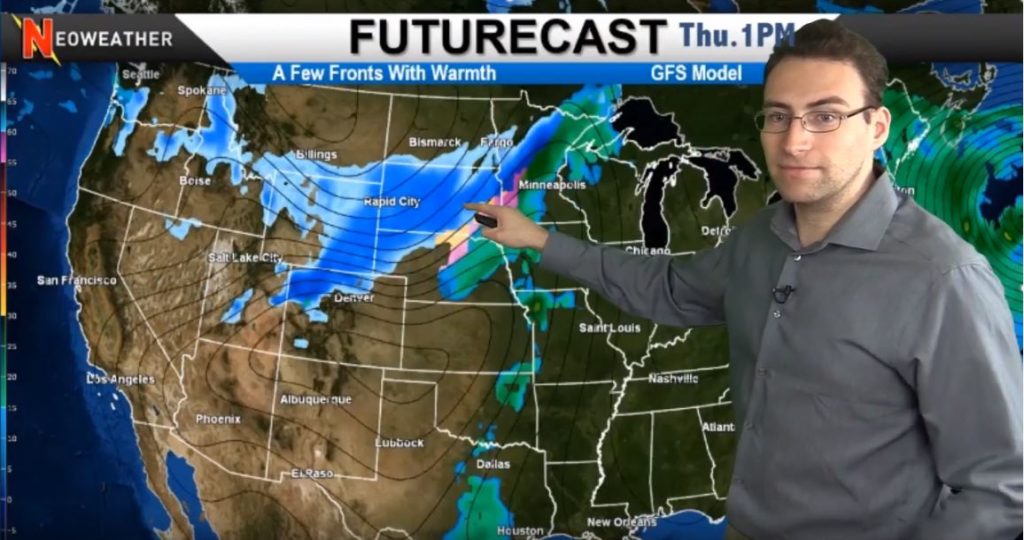
The snowmaker pops up Thursday and Friday in the Western Plains starting in the higher elevations, but then it sticks around and moves east. Snow is expected in Montana, Wyoming, Colorado, Nebraska, the Dakotas, Minnesota, and parts of Iowa and Wisconsin. The system diffuses as it moves east after that and warm air from the South also comes up to make it a rain-only system from that point forward. Meanwhile, more snow pops up in the Pacific Northwest, again in higher elevations through the weekend and into next week.
Looking for the best weather information to help you do your job? Stop using generic apps and start making better decisions with a customized forecast created just for YOUR service area. Contact Neoweather for details and pricing!