Mild Wet Weather to Start, Then Snow
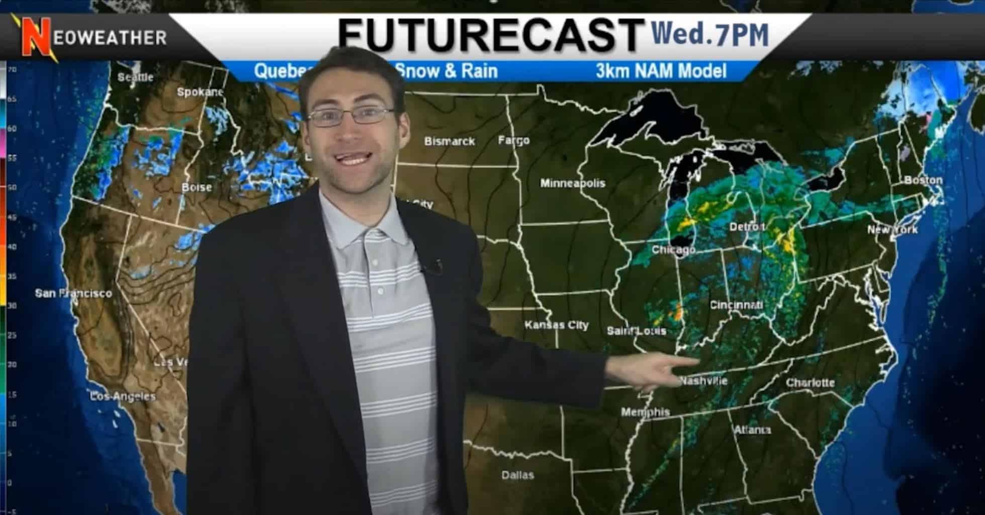
This week starts off with a mostly dry country except for the Ohio Valley and Southeast where there will be some significant rain and some storm potential. The Northeast could see an inch or two of rain. The next big system pushes down from the North early next week with a crazy cyclone swirl of cold weather that could amount to some significant snow in the Midwest.
Today’s weather is dry and uneventful nationwide with exceptions in the Northern Rockies, where there are some pockets of snow, and the Ohio and Tennessee Valleys where a pretty significant system is brewing up. A super soaker stretches from the Great Lakes all the way down to the Gulf on Wednesday. Severe weather is expected in the South and in the most northern areas, there may be some snow – especially up in Maine and Canada. Some spots in those areas could see up to 4-5 inches of snow. Snow accumulation is expected since temperatures will be in the 20’s.
On Thanksgiving, there is literally no precipitation expected in nearly all of the country. This changes dramatically starting Friday and into the weekend when a helluva system pops up that actually gets a part 2 early next week.

Cyclone of Cold Air & Pressure
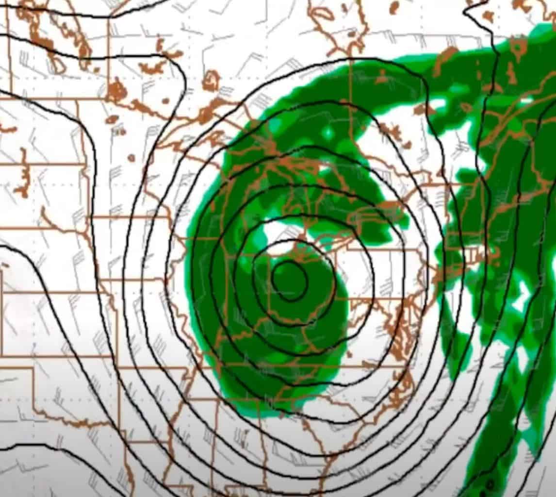
A big blast of cold air is expected to come down from Canada early next week. It brings with it a cyclone of tight pressure and windy conditions combined with moisture that is expected to swirl around and make things interesting. A big spinning trough of air is going to create a trough in the Central U.S. and East causing a high potential for more snowstorms.
The northern jet stream is expected to collide with the southern jet stream causing a condition known as “phasing.” In the past, collisions like this have created some of our biggest snowstorms, but we’re not sure yet how significant it will be next week. It’s something to keep an eye on for sure.
Where will the snow hit?
It’s too soon to tell. It might fall across the Appalachian Mountains, or maybe in the heart of the Midwest. Either way, many of the models are projecting the potential for a big-time winter storm early next week.
Early December Temperatures Below Average

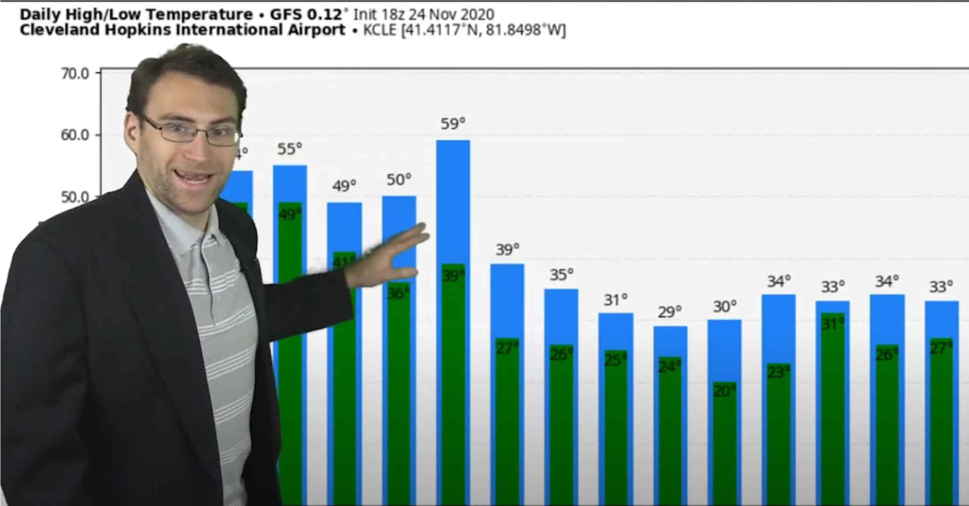
Brian Ivey from Neoweather took a look at the average temperatures versus the expected temperatures in Ohio for the end of November and going into the first week or so of December. See the image above where average temps are shown in blue and expected temps are shown in green for Nov 24 through Dec 9, 2020.
11/25/2020 Weather Forecast Video
Watch Neoweather’s winter forecast for snow contractors video below for all the details on this week during Thanksgiving, as well as a bit on the changes expected for next week.
Weather Forecasting Services for Snow Contractors
If you would like to join your colleagues and get a quote on private forecasting services to help you run your snow contracting business, contact Neoweather today! You may be surprised at how you can save money and time with their services!
